Stop 4: Lava Flow Succession

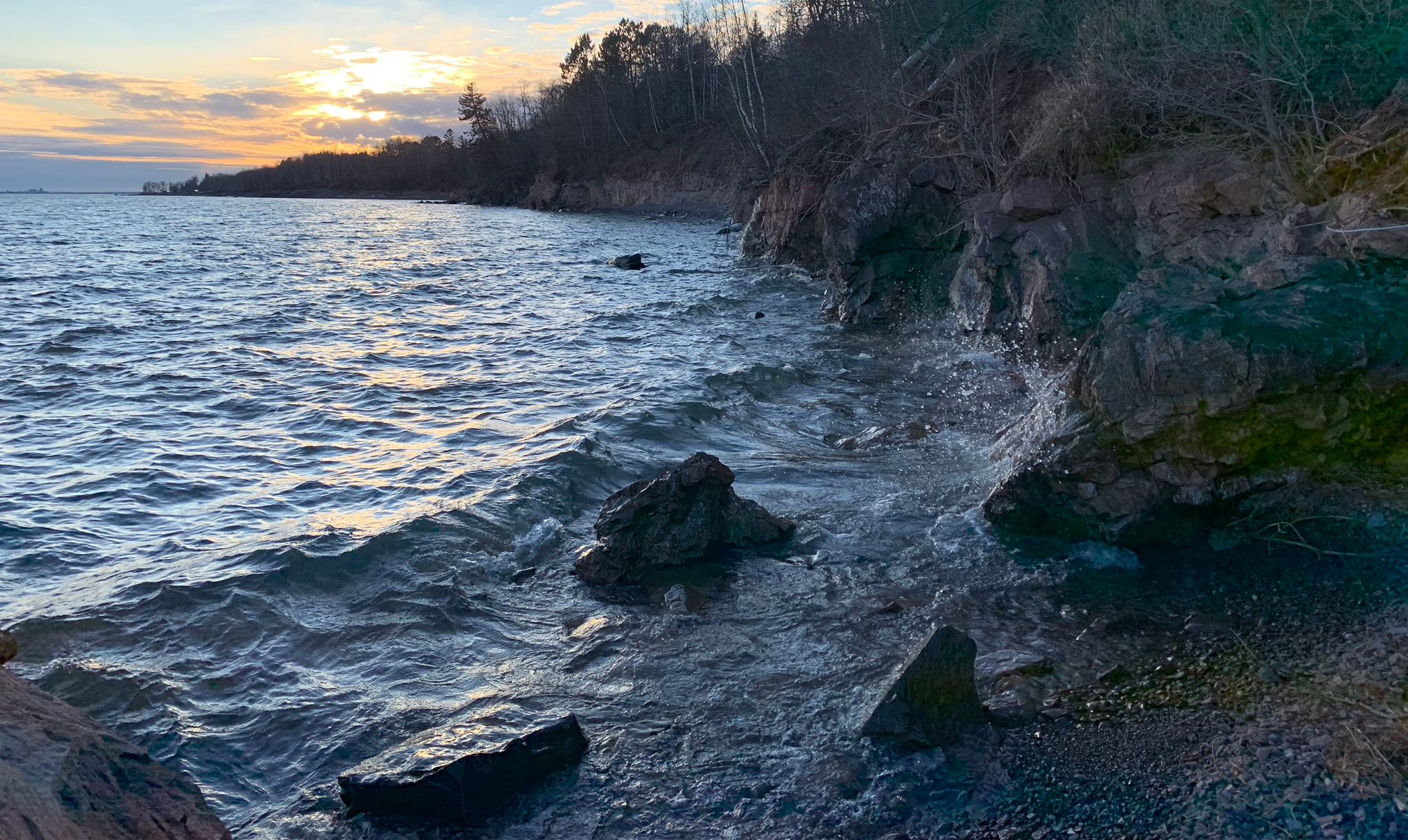
This weekend we got a blessing of fall weather! Yesterday got into the mid-40’s, and today was 50°F! So, that ice finally melted off the ledges and I could get all the way out. To follow along with the stop description, check out the book share in the previous post  Stop 4 (p. 135). Instead of the direction to get to the starting place, I like to make my way there from the parking place. I think the starting place is also what’s referred to as “the southwest end of the wider part of the ledges.” In my amateur geology learning adventure, this is my best guess at interpreting this stop.

IMG_0363
“This 80-m thick, porphyritic flow…continues for a considerable distance along the cliffs to the southwest, interrupted by a basalt dike.”

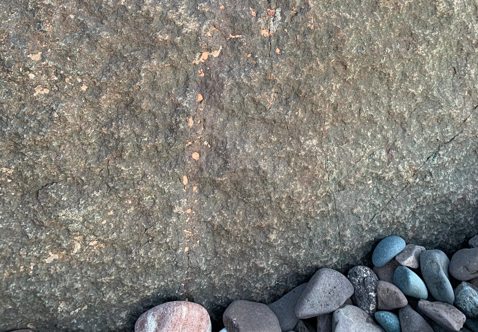
I can see what looks like a basalt dike, but wading out there will have to wait until summer 2020. The next sentence is unclear as to whether the sandstone lenses are there or “here” where the overlying basalt flow contacts the rhyolite flow.

IMG_0366
“…rapidly becomes massive and subophitic in its central portion.”

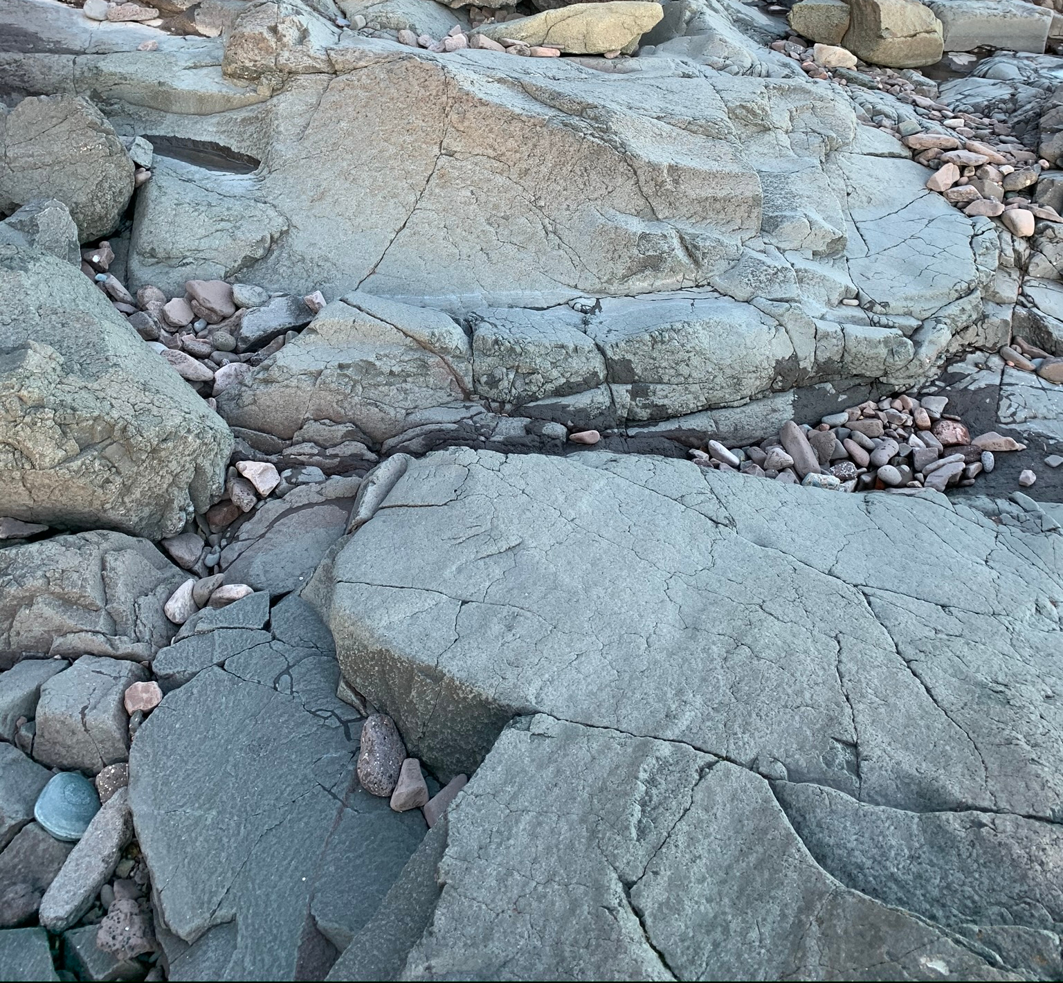
I’m assuming this is the massive portion without amygdules.

IMG_0369
“Farther up in the central part of the flow (to the northeast), vesicle cylinders are prominent…”

Given the diagram (Fig. 11 A, p. 131) I think this is a vesicle cylinder.

IMG_0372
“At the top are several very thin flow units showing well-preserved ropy surfaces and lobes…This flow is overlain by several others…”

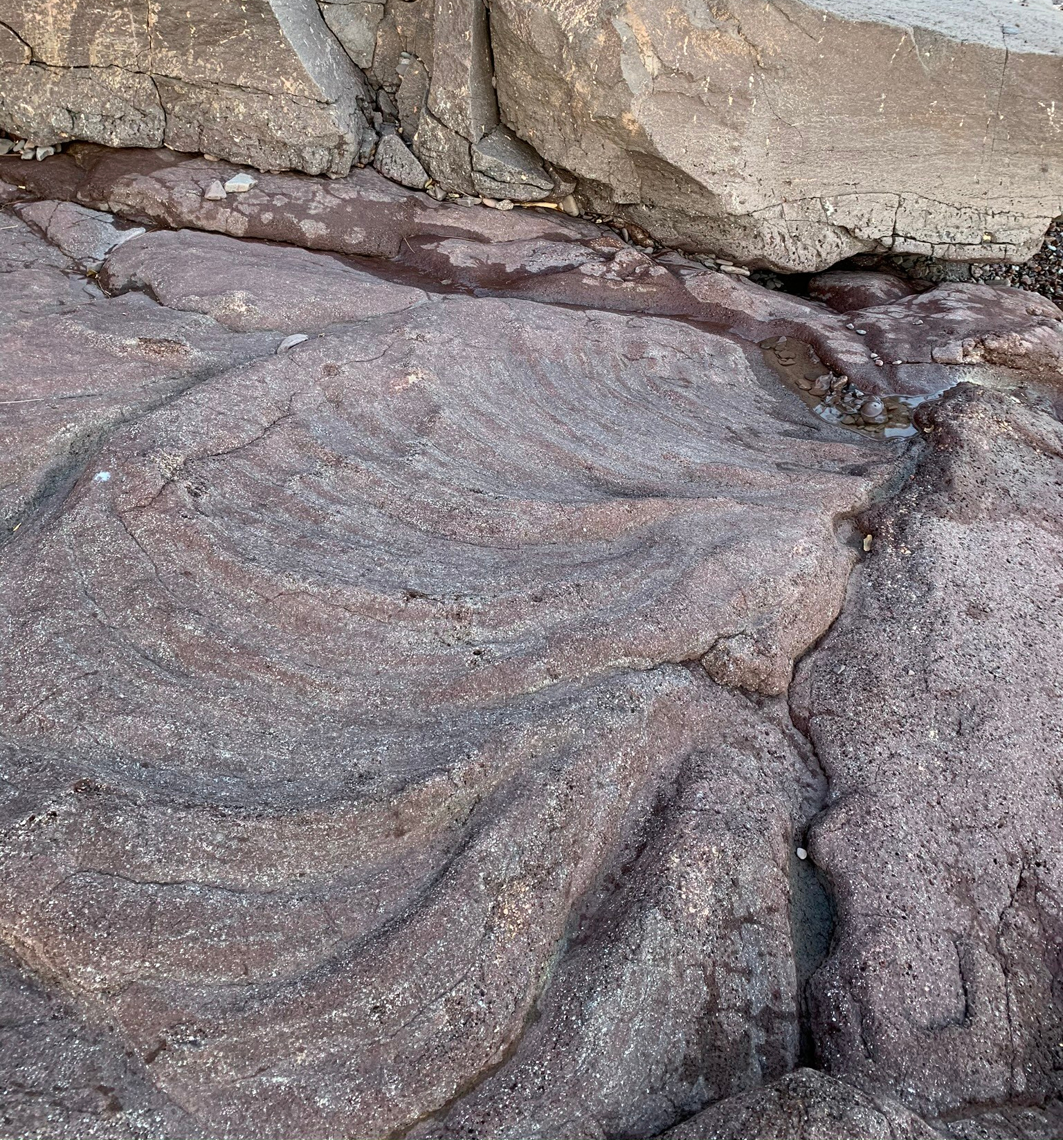
This is the part I feel the most confident in interpreting, and it’s one of my favorite spots! Above the pahoehoe top of the flow is the contact with another flow. This is the best example of pipe vesicles I’ve ever found, with what I believe are vesicle cylinders above in the massive portion!

IMG_0377.JPEG
“At the next ‘pocket beach’ at a small stream gully, climb up to the highway.”

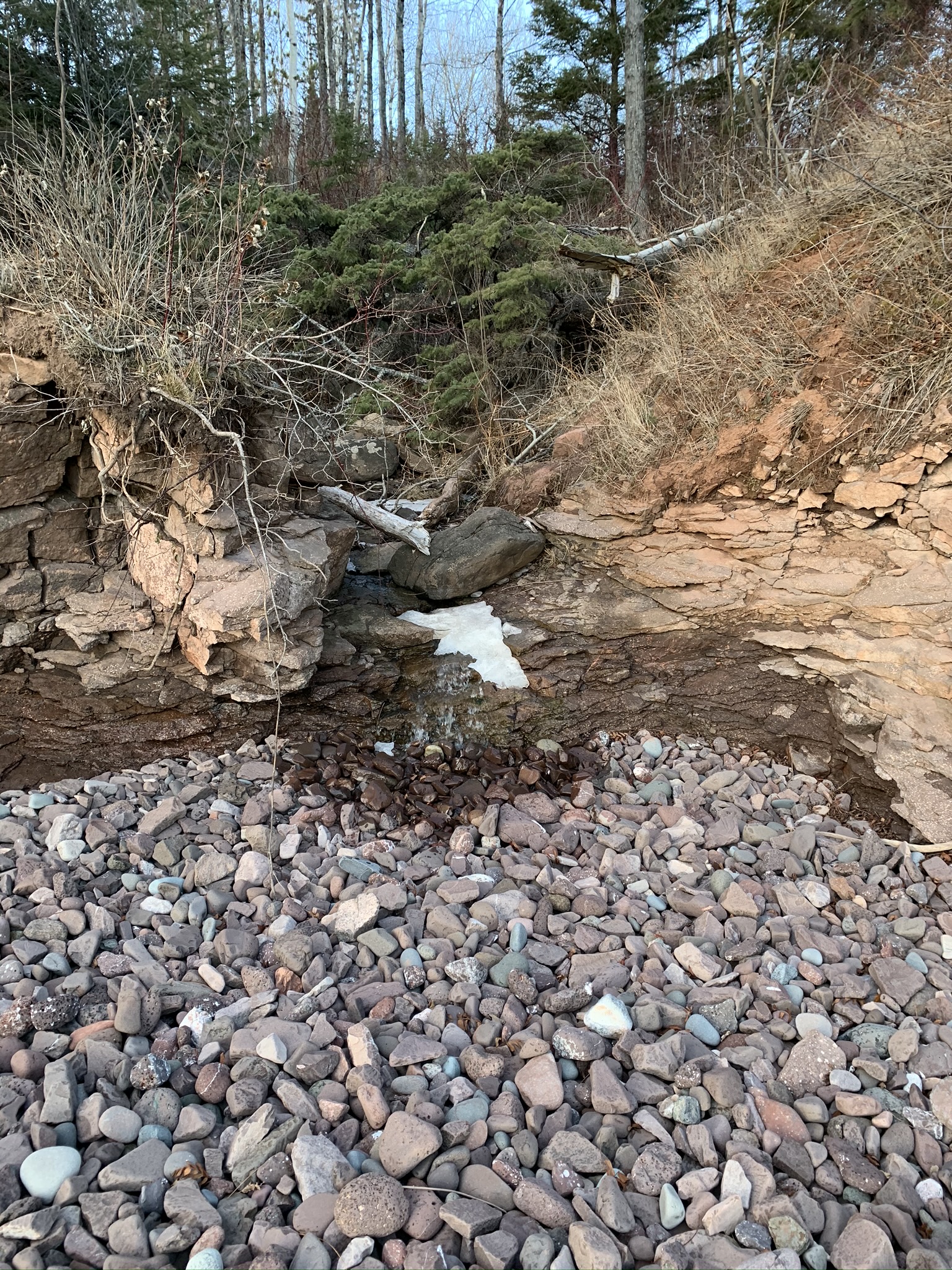
This is again where I prefer to climb down to get to all these spots.

Weekend GIS Fun: Part 3

I had been referencing stops from the original north shore geology field trip guide, until I found an updated version of the guide in a book (embedded below p.132-144)!

In this chapter, he lists the military grid reference system (MGRS) coordinates (Green 2011) so I entered them into a spreadsheet. I then downloaded it as a comma separated values (CSV) sheet to convert it to a spatial object. The main highlight of this script is how I dealt with different MGRS zones for points in the same data frame:

library(sf)
plot_locations_HARV <- read.csv("geology.csv")
co <- st_read(dsn="counties_in_minnesota", layer="mn_county_boundaries")
pts <- lapply(1:nrow(plot_locations_HARV),function(x){
   point <- plot_locations_HARV[x,]
   epsg <- ifelse(as.integer(gsub("[^[:digit:]]","",point$utm))==15,2027,2028)
   pt <- st_as_sf(point, coords = c("E", "N"))
   this_crs <- st_crs(paste0("+init=epsg:",epsg))
   st_crs(pt) <- this_crs
   pt_project <- st_transform(pt, st_crs(co))
return(pt_project)})
df <- do.call(rbind, pts)
st_write(df, dsn="geology", layer="geology", driver= "ESRI Shapefile")

I assigned the numeric part of the MGRS zone as the Universal Transverse Mercator (UTM) zone. From there, I did my best assigning a coordinate reference system (CRS) to the points accordingly. I ultimately wanted it in the same projection as the MN county layer.

I’ll resume my efforts to “ground truth” the locations as soon as the conditions are right, and to add some additional points corresponding to details in the stop descriptions. If next weekend doesn’t allow the ice to thaw, that will probably mean in the spring!

Literature Cited

Green, John C., et al. “The North Shore Volcanic Group: Mesoproterozoic plateau volcanic rocks of the Midcontinent Rift system in northeastern Minnesota.” Archean to Anthropocene: Field Guides to the Geology of the Mid-Continent of North America: Geological Society of America Field Guide 24 (2011): 121-146.

Weekend GIS Fun: Part 2

See part 1 for the relevant shape file and description of what’s going on! In the last post, we identified the map codes of interest to subset the shape file. Here’s some code for working with it in R.

library(rgdal)
bedrock <- readOGR(dsn="~/Arrowhead_South_Bedrock_Geology","Arrowhead_South_Bedrock_Geology")
basalt = subset(bedrock,map_label=="Mnd" | map_label=="Mna")
writeOGR(basalt,dsn=".",layer="basalt",driver="ESRI Shapefile")

So now we have a shape file of the diabase-textured basalt and andesite! To take it in the field, I found this great iPhone app. Once I had the shape file loaded into a project, I could see my GPS location for navigation.

Here’s a non-GIS based hint of where to find pipe vesicles. In biological news, I saw a Franklin’s ground squirrel at Brighton Beach today!

My Best Agate Yet!

I found this gem while poking around Flood Bay this afternoon! It’s a fortification and a floater agate, which is mostly micro-crystalline quartz.

d15acda0-0280-4a62-a8e3-d2f0c0e1168b

2ab16bb5-4348-476e-8c27-92a282f9ce30
a mostly intact nodule

Last weekend, my I taught my boyfriend about agate hunting, and we found a number of them. There’s a corner of this one (left) that’s broken to reveal very fine banding, but it’s too small to photograph with my iPhone. Instead, I wanted to photograph the (admittedly less photogenic) exterior, which represents a complete agate. The surface is what would have been touching the vesicle in which the agate formed. The bands are in the interior of the agate.


Stoney Point

I cleared up the “ophitic basalt” debate, at least to my satisfaction, this evening. I went to a beach listed in my book to have a good amount of ophitic basalt, and it looks quite different to me than what I would identify as diabase (I found some of that there too).

Basalts

Most of the rocks at Flood Bay are basalt. I’m still confused about how to differentiate ophitic basalt from diabase, though. One of my books draws a distinction, but another doesn’t. I read into it online, but I’ll have to keep studying in the field!

Learning Rocks

When I was in early elementary school, I really liked rocks, but my interest in minerals wore out sometime not long thereafter. When I was little, I remember looking through the gravel with friends, the prizes being chalk rocks, quartz and the occasional geode you could break open, which were my favorite finds! We used to have this cool nature and science store in the mall (where are stores like that these days?) which was my favorite store as a kid, and I used to like to go pick out polished, identified rocks for my collection. Maybe it was an early influence from my mom, who once wanted to be a geologist before she got into teaching. (We still visit some cool geological sites and she collects rocks.)  Anyway, it’s been a joy to rediscover that interest living on the shore of Lake Superior, and I looked for rocks with my parents when they came to visit for Labor Day weekend. The many-colored rocks on the beaches can’t help but inspire curiosity!

I got a small magnifying lens (I can’t find my loupe but I need another one if it doesn’t turn up…) to take with me on the beach, and re-examined some of my finds tonight in light of what I’m learning. I don’t know what magnification you need to tell rhyolite from basalt; in the “simpler” book I have about rock collecting on the north shore, the authors seem to distinguish by color. However, in the more complex guide to the Lake Superior shores, they say that the grain of the rock is what distinguishes the two. I looked at what I have so far and it’s hard to say if what I think is rhyolite is significantly “coarser” than the basalt. The samples seem to match the photos, so I’m just going to guess I’m on the right track so far.

4f8aeccf57ff8aa27917953ef4691248
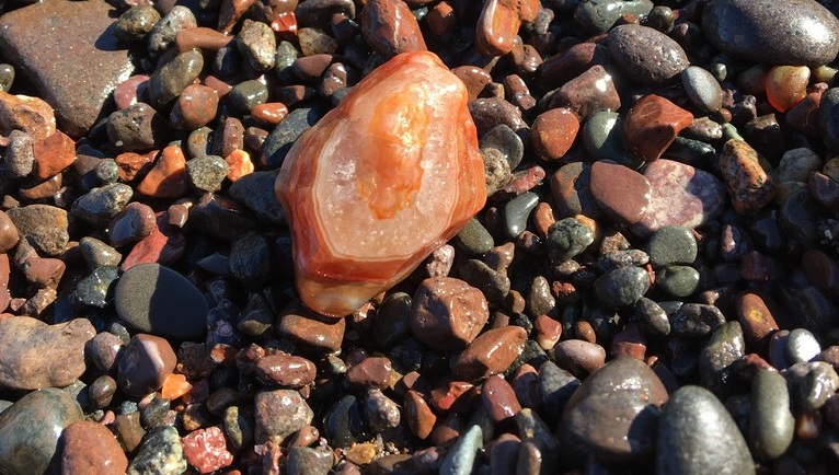
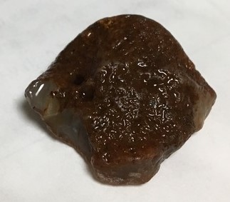
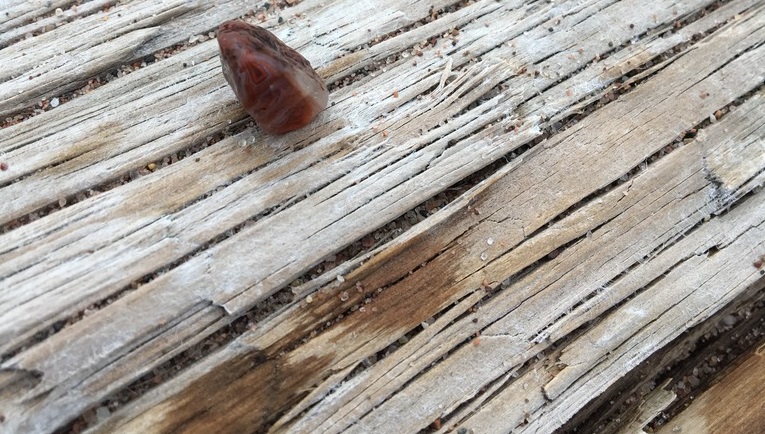
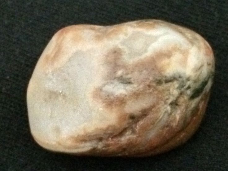
I’ve found quite a few agates and fragments by now, most of them predictably small. I might need more mag to get at the features on the tiny ones. I’d love to find (or confirm among my collection) a brecciated agate. Breccia is formed when a rock breaks and is cemented back together. In the case of agates, I think the substrate can be anything, but I think breccia agate most commonly found amidst quartz and silica.

Flood Bay

As highlighted in the feature photo, it’s hard to come to Lake Superior and not notice the rocks. There are seemingly so many different kinds of beautiful colors along the shore. I learned about agates and began looking for them along the beach, but I wanted to know about everything I was encountering, so I bought an ID book and have been visiting a few spots mentioned therein. After work today, I headed to the beach that is mentioned to have the most “vesicular” rocks among the spots listed. There were indeed giant blocks of vesicular basalt that were probably put there as something of a break wall.

This did seem to be a popular “rock hounding” spot though, so the agates were probably gone for the day. I noticed a few people looking for rocks while I was there. I picked up a few interesting rocks that I haven’t looked into much yet for identification.

A Tiny Lake Superior Agate and Other Rocks

TGIF! I really like my new “rock picking” hobby. Today, I found a tiny piece(?) of an agate, and continued to grow my rock collection.

9ba14bfe-b08d-40e7-b565-a0c079ef59f6
the red banding is rust!

I have found lots of basalt (including ophitic, diabase, gabbro, and vesicular). I’d love to find basalt with pipe vesicles but I’m not sure what my odds of that would be. I have also found some pretty granite, but I’d like to pay more attention to these beautiful rocks in upcoming outings.